Station Overview
| Overview Location |
 |
|---|---|
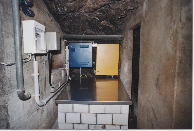
| Picture Gallery | details... |
| Geological Unit | Limestone (Upper Jurassic) |
|---|---|
| Site Morphology Class |
T2 T1: flat; T2: slope; T3: ridge and T4: steep ridge; following Pessina and Fiorini (2014) A GIS procedure for fast topographic characterization of seismic recording stations, Soil Dynamics and Earthquake Engineering, 63, p248-258 |
| Site Morphology Description | Foot of a cliff |
| Ground type EC8 | A |
| Ground type SIA | A |
| Basin Information | not in a sedimentary basin with possible 2D/3D effects |
| Reference | Fäh Donat, Fritsche S., Poggi V. et al., "Determination of Site Information for Seismic Stations in Switzerland. Work Package 4: Pegasos Refinement Project", Swiss Seismological Service, ETH Zürich, 2009 |
Current Instrumentation
| Location code | (none) |
|---|---|
| On date | 22-07-2020 16:00:00 |
| Off date | - |
| Sensor model | EpiSensor ES-T |
| Sensor manufacturer | Kinemetrics |
| Digitizer model | Q330HRS |
| Digitizer manufacturer | Quanterra |
| Channels | HGE , HGN , HGZ |
| Stream Noise (last week) | HGE , HGN , HGZ |
| Location code | (none) |
|---|---|
| On date | 22-07-2020 16:00:00 |
| Off date | - |
| Sensor model | STS2_gen3 |
| Sensor manufacturer | Streckeisen |
| Digitizer model | Q330HRS |
| Digitizer manufacturer | Quanterra |
| Channels | BHE , BHN , BHZ , HHE , HHN , HHZ |
| Stream Noise (last week) | BHE , BHN , BHZ , HHE , HHN , HHZ |
| Location code | (none) |
|---|---|
| On date | 21-07-2005 00:00:00 |
| Off date | 2020-07-22 16:00:00 |
| Waveform Access | open |
| Sensor model | STS2_gen3 |
| Sensor manufacturer | Streckeisen |
| Digitizer model | HRD24 |
| Digitizer manufacturer | Nanometrics |
| Channels | BHE , BHN , BHZ , HHE , HHN , HHZ |
| Location code | (none) |
|---|---|
| On date | 24-05-2000 00:00:00 |
| Off date | 2005-07-21 00:00:00 |
| Waveform Access | open |
| Sensor model | STS2_gen3 |
| Sensor manufacturer | Streckeisen |
| Digitizer model | HRD24 |
| Digitizer manufacturer | Nanometrics |
| Channels | BHE , BHN , BHZ , HHE , HHN , HHZ |
Site Characterization
|
channel group |
Empirical Amplification |
|---|---|
| CH.WIMIS..HG | 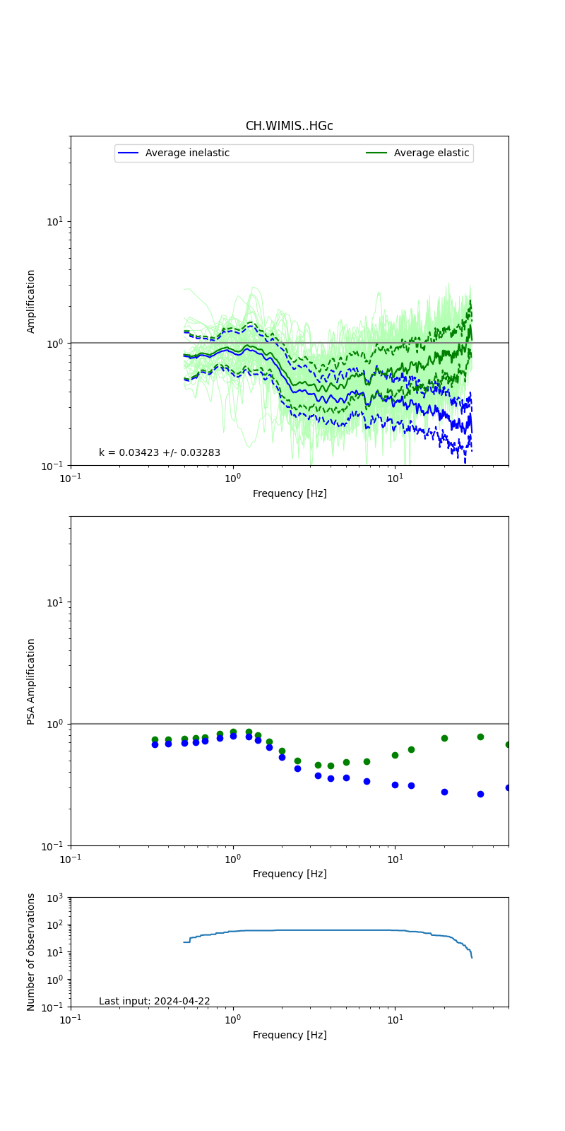 |
| CH.WIMIS..HH | 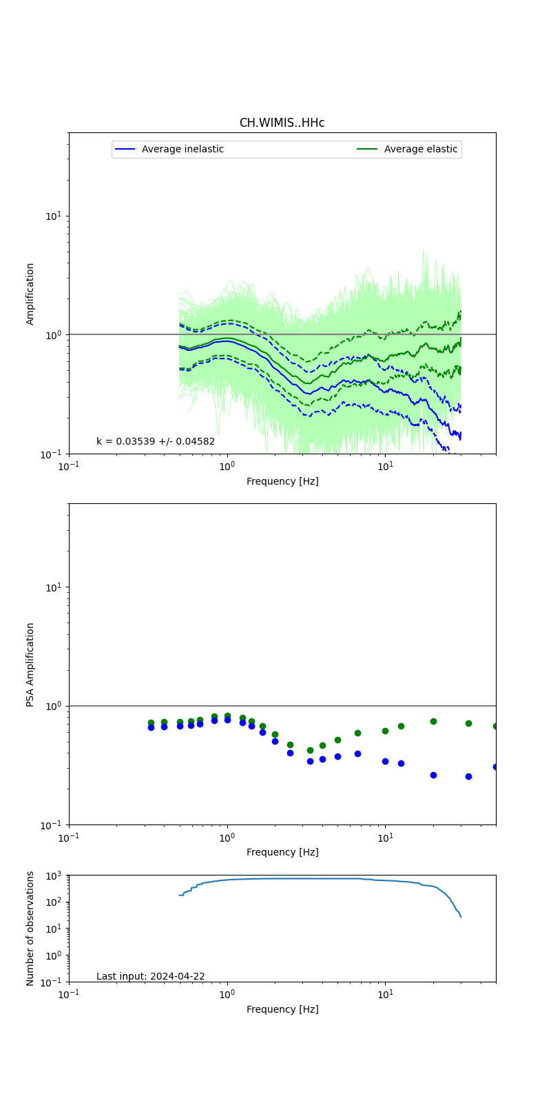 |
Obtained from spectral modeling of small earthquakes with constant update.
- Top: Fourier amplification with elastic (dashed line) and anelastic (solid line) amplification functions;
- Centre: 5% damped response spectra amplification (anelastic);
- Bottom: Number of recordings used.
See Edwards et al. (2013), Determination of Site Amplification from Regional Seismicity: Application to the Swiss National Seismic Networks. Seismological Research Letters, 84(4), 611–621.
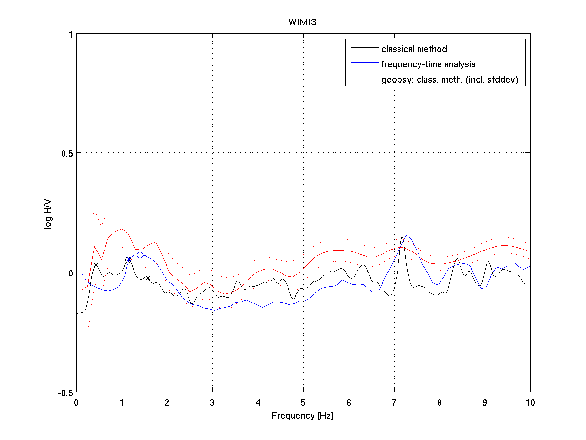
| H/V pick image: |
 |
|---|---|
| Authoritative Site Characterization Analysis | details... |
| measurements nearby | list... |
|---|