| Location code | (none) |
|---|---|
| On date | 13-09-2018 13:00:00 |
| Off date | 2020-05-14 11:00:00 |
| Waveform Access | open |
| Sensor model | LE-3Dlite MkII |
| Sensor manufacturer | Lennartz |
| Digitizer model | Centaur |
| Digitizer manufacturer | Nanometrics |
| Channels | EHE , EHN , EHZ |
| Location code | (none) |
|---|---|
| On date | 22-05-2018 11:00:00 |
| Off date | 2018-09-13 13:00:00 |
| Waveform Access | open |
| Sensor model | LE-3Dlite MkII |
| Sensor manufacturer | Lennartz |
| Digitizer model | Centaur |
| Digitizer manufacturer | Nanometrics |
| Channels | EHE , EHN , EHZ |
Site Characterization
|
channel group |
Empirical Amplification |
|---|---|
| 9S.ILL18..EH | 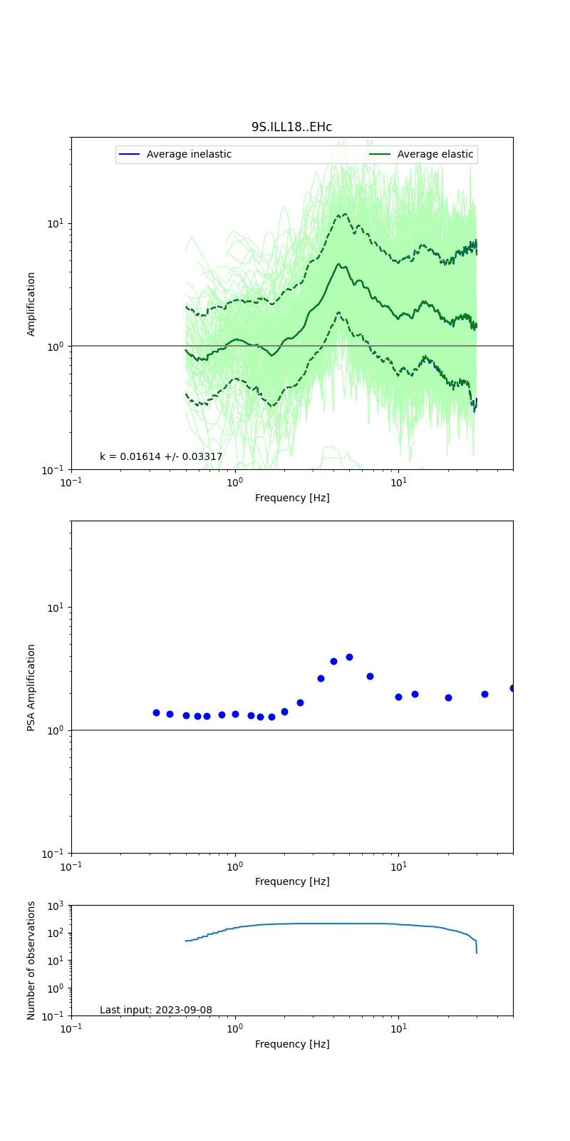 |
Obtained from spectral modeling of small earthquakes with constant update.
- Top: Fourier amplification with elastic (dashed line) and anelastic (solid line) amplification functions;
- Centre: 5% damped response spectra amplification (anelastic);
- Bottom: Number of recordings used.
See Edwards et al. (2013), Determination of Site Amplification from Regional Seismicity: Application to the Swiss National Seismic Networks. Seismological Research Letters, 84(4), 611–621.
| measurements nearby | list... |
|---|