Sensor locations
| Location Code | (none) |
|---|---|
| Opening Date | 23-10-2015 |
| End Date | - |
| Housing Class | Building |
| Housing Description | Sensor in basement of 2story building with building footprint 33m x 21m. Building type: Granit block bunker. Building density: isolated building. Building usage: historic military bunker (built 1886), out of use Sensor coupling information: Sensor on alu tripod, an concrete foundation, hard rock below foundation comments: station running on a fuel cell. |
| sensor depth below station | 0.0 m |
| Distance to Building (m) | - |
Site Characterization
|
channel group |
Empirical Amplification |
|---|---|
| 8R.GSF03..HH | 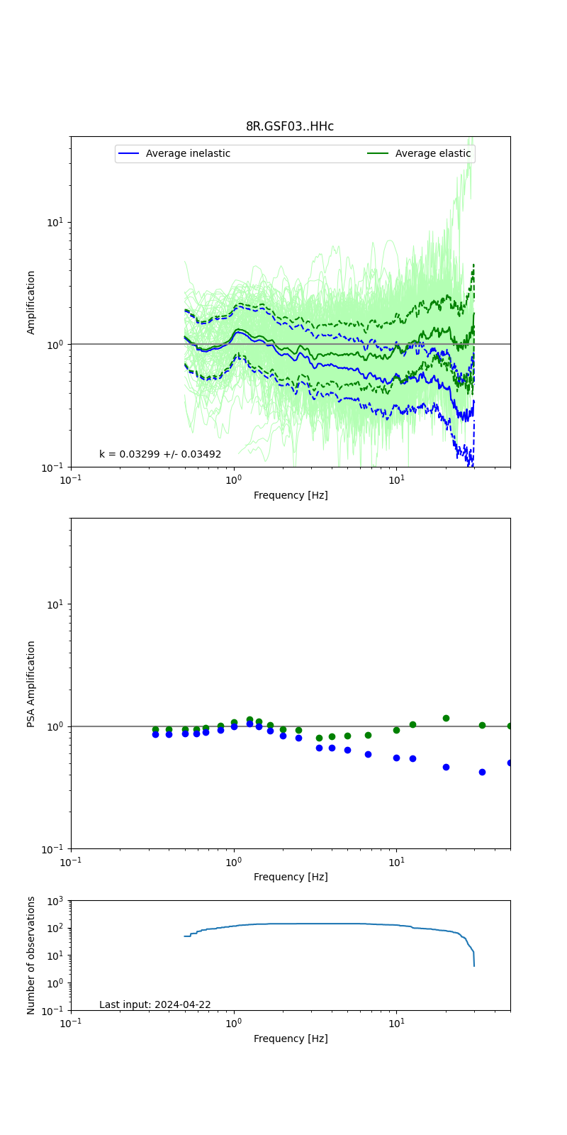 |
| 8R.GSF03..EH | 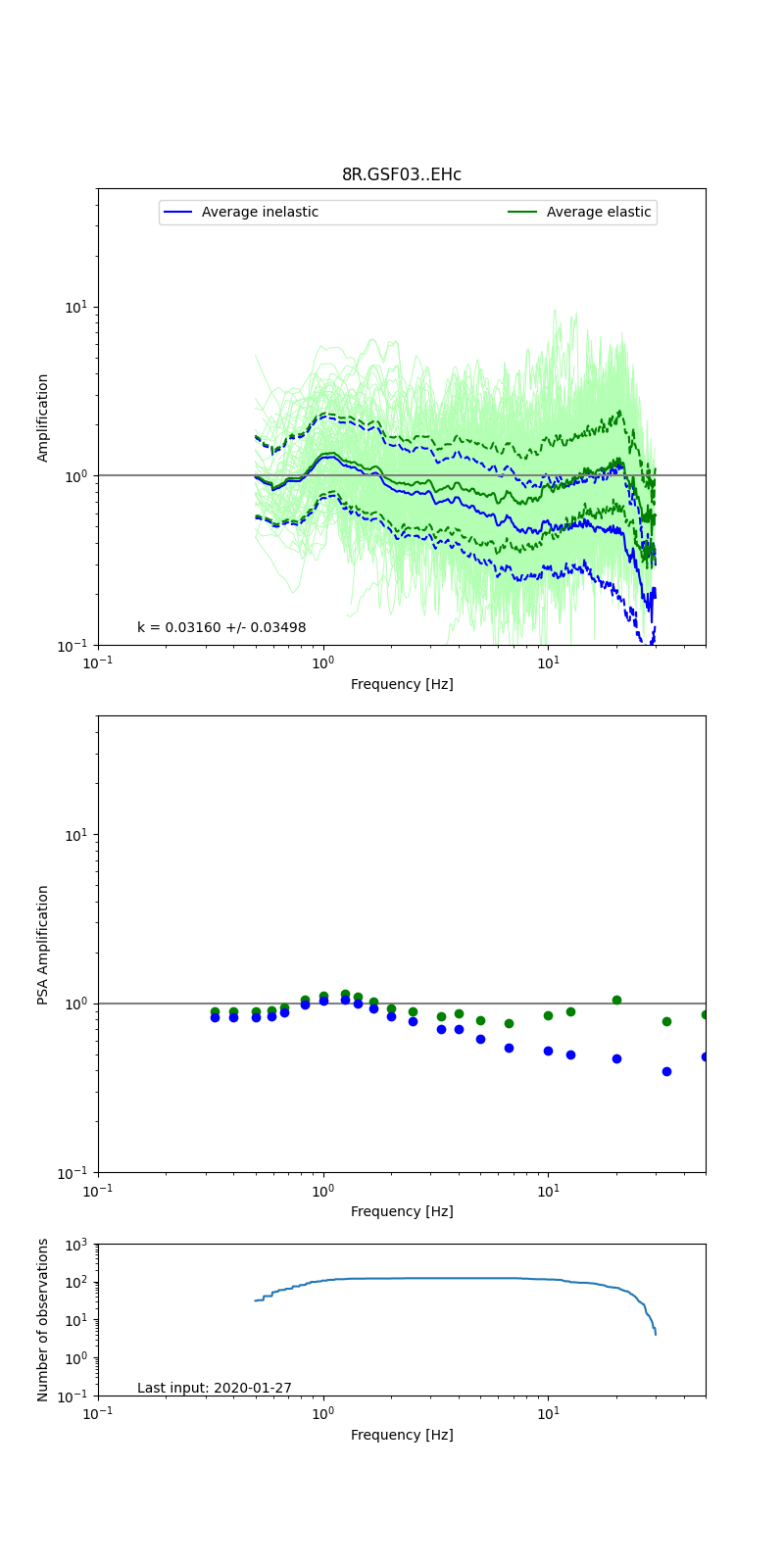 |
Obtained from spectral modeling of small earthquakes with constant update.
- Top: Fourier amplification with elastic (dashed line) and anelastic (solid line) amplification functions;
- Centre: 5% damped response spectra amplification (anelastic);
- Bottom: Number of recordings used.
See Edwards et al. (2013), Determination of Site Amplification from Regional Seismicity: Application to the Swiss National Seismic Networks. Seismological Research Letters, 84(4), 611–621.