| Location code | (none) |
|---|---|
| On date | 03-11-2015 00:00:00 |
| Off date | 2016-08-16 00:00:00 |
| Waveform Access | open |
| Sensor model | LE-3D-BH |
| Sensor manufacturer | Lennartz |
| Digitizer model | Taurus |
| Digitizer manufacturer | Nanometrics |
| Channels | EH2 , EH3 , EHZ |
| Location code | (none) |
|---|---|
| On date | 19-07-2015 12:38:16 |
| Off date | 2015-07-22 06:22:57 |
| Waveform Access | open |
| Sensor model | LE-3D-BH |
| Sensor manufacturer | Lennartz |
| Digitizer model | Taurus |
| Digitizer manufacturer | Nanometrics |
| Channels | EH2 , EH3 , EHZ |
| Location code | (none) |
|---|---|
| On date | 14-06-2015 10:47:26 |
| Off date | 2015-06-17 06:18:44 |
| Waveform Access | open |
| Sensor model | LE-3D-BH |
| Sensor manufacturer | Lennartz |
| Digitizer model | Taurus |
| Digitizer manufacturer | Nanometrics |
| Channels | EH2 , EH3 , EHZ |
| Location code | (none) |
|---|---|
| On date | 11-02-2015 10:44:29 |
| Off date | 2015-03-05 03:52:29 |
| Waveform Access | open |
| Sensor model | LE-3D-BH |
| Sensor manufacturer | Lennartz |
| Digitizer model | Taurus |
| Digitizer manufacturer | Nanometrics |
| Channels | EH2 , EH3 , EHZ |
Site Characterization
|
channel group |
Empirical Amplification |
|---|---|
| 4D.AG03..EH | 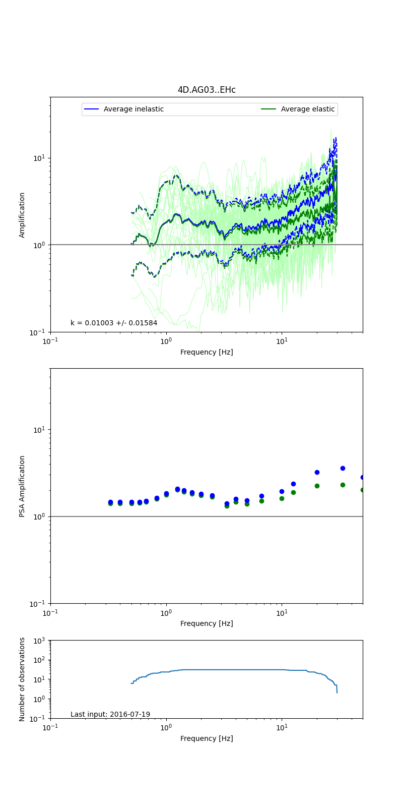 |
Obtained from spectral modeling of small earthquakes with constant update.
- Top: Fourier amplification with elastic (dashed line) and anelastic (solid line) amplification functions;
- Centre: 5% damped response spectra amplification (anelastic);
- Bottom: Number of recordings used.
See Edwards et al. (2013), Determination of Site Amplification from Regional Seismicity: Application to the Swiss National Seismic Networks. Seismological Research Letters, 84(4), 611–621.
| measurements nearby | list... |
|---|