Station Overview
| Overview Location | not available |
|---|---|
| Picture Gallery | details... |
| Geological Unit | Alluvium |
|---|---|
| Site Morphology Class |
T1 T1: flat; T2: slope; T3: ridge and T4: steep ridge; following Pessina and Fiorini (2014) A GIS procedure for fast topographic characterization of seismic recording stations, Soil Dynamics and Earthquake Engineering, 63, p248-258 |
| Site Morphology Description | Centre of the Rhone alluvial plain |
| Ground type EC8 | C |
| Ground type SIA | D |
| Basin Information | Rhone basin, interface at fundamental frequency at 150 m depth |
| Reference | Burjanek Jan, Fäh D., "Expected seismic velocity profile for the suggested borehole location in Visp", Swiss Seismological Service, ETH Zürich, 2010 |
| Location code | (none) |
|---|---|
| On date | 18-11-2008 00:00:00 |
| Off date | 2009-04-29 00:00:00 |
| Waveform Access | open |
| Sensor model | LE-3D-5s |
| Sensor manufacturer | Lennartz |
| Digitizer model | |
| Digitizer manufacturer | |
| Channels | EHE , EHN , EHZ |
| Location code | (none) |
|---|---|
| On date | 05-11-2007 00:00:00 |
| Off date | 2008-05-12 00:00:00 |
| Waveform Access | open |
| Sensor model | STS2_gen3 |
| Sensor manufacturer | Streckeisen |
| Digitizer model | |
| Digitizer manufacturer | |
| Channels | EHE , EHN , EHZ , HHE , HHN , HHZ |
Site Characterization
|
channel group |
Empirical Amplification |
|---|---|
| 2A.VISP2..EH |  |
| 2A.VISP2..HH | 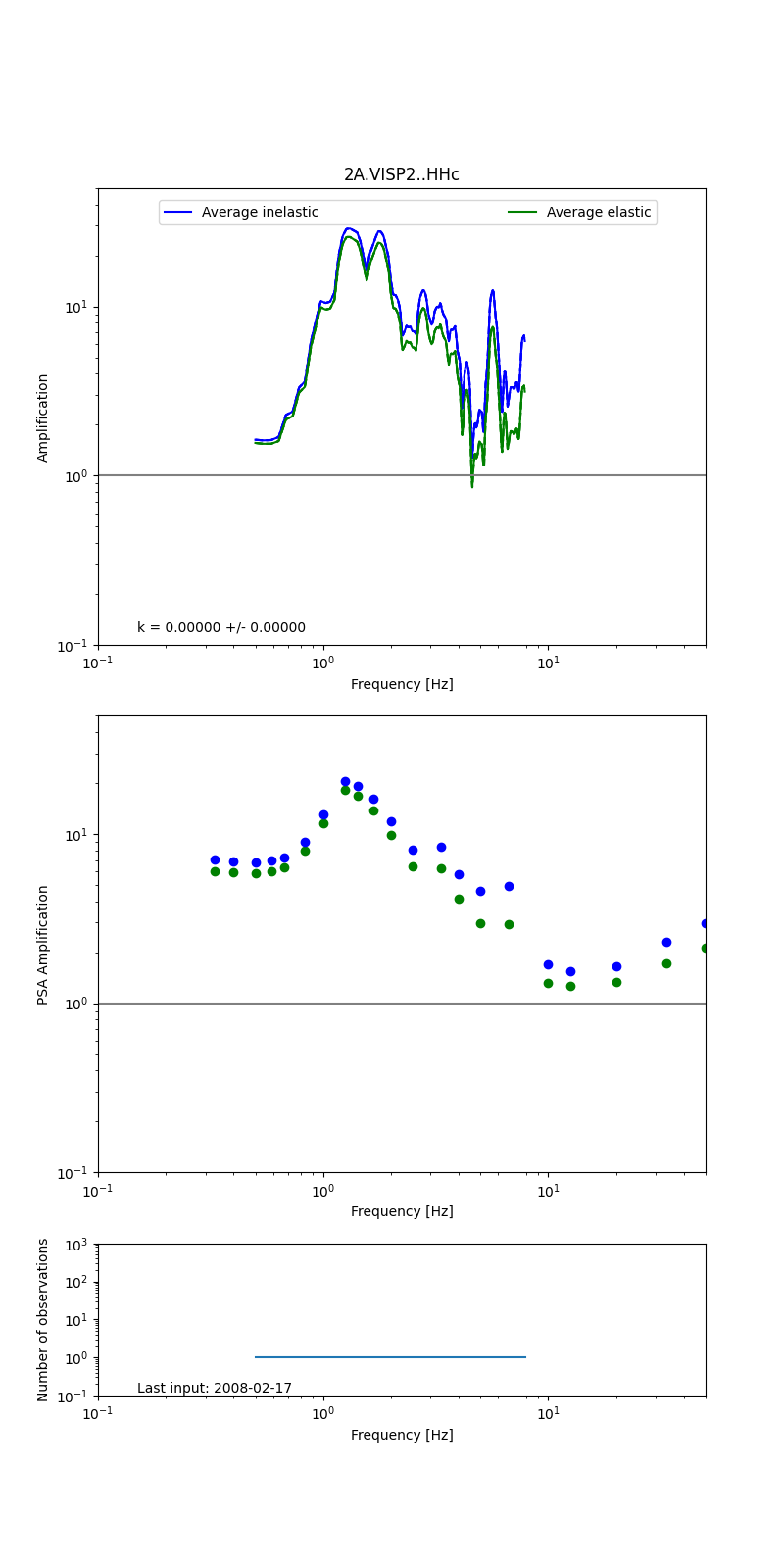 |
Obtained from spectral modeling of small earthquakes with constant update.
- Top: Fourier amplification with elastic (dashed line) and anelastic (solid line) amplification functions;
- Centre: 5% damped response spectra amplification (anelastic);
- Bottom: Number of recordings used.
See Edwards et al. (2013), Determination of Site Amplification from Regional Seismicity: Application to the Swiss National Seismic Networks. Seismological Research Letters, 84(4), 611–621.
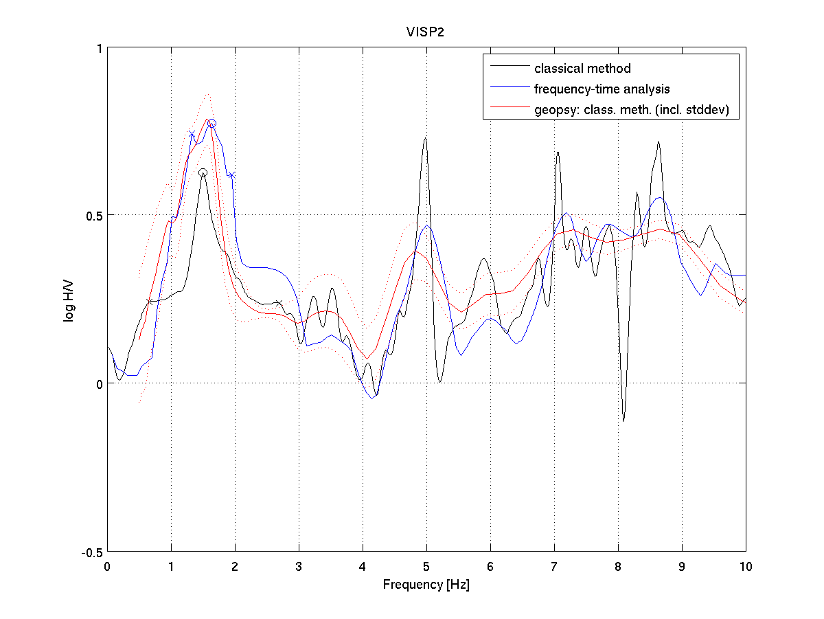
| H/V pick image: |
 |
|---|---|
| Authoritative Site Characterization Analysis | details... |
| measurements nearby | list... |
|---|