Sensor locations
| Location Code | (none) |
|---|---|
| Opening Date | 12-11-2021 |
| End Date | - |
| Housing Class | Underground shelter |
| Housing Description | Sensors are located in the south-western corner of a technical room/building, 5m below free surface, 2m from nearest entrance. Part of the building was built into an approximately 90m high, almost vertical rock face, right at the southern end of a dam. About 1m of the western part of the room, where the sensors are located, protrudes from the rock face. Building usage: rarely used as temporary storage. Sensors placed on concrete floor. |
| sensor depth below station | 0.0 m |
| Distance to Building (m) | - |
Current Instrumentation
| Location code | (none) |
|---|---|
| On date | 12-11-2021 16:00:00 |
| Off date | - |
| Sensor model | EpiSensor ES-T |
| Sensor manufacturer | Kinemetrics |
| Digitizer model | Q330HRS |
| Digitizer manufacturer | Quanterra |
| Channels | HGE , HGN , HGZ |
| Stream Noise (last week) | HGE , HGN , HGZ |
| Location code | (none) |
|---|---|
| On date | 12-11-2021 16:00:00 |
| Off date | - |
| Sensor model | STS2_gen3 |
| Sensor manufacturer | Streckeisen |
| Digitizer model | Q330HRS |
| Digitizer manufacturer | Quanterra |
| Channels | BHE , BHN , BHZ , HHE , HHN , HHZ |
| Stream Noise (last week) | BHE , BHN , BHZ , HHE , HHN , HHZ |
Site Characterization
|
channel group |
Empirical Amplification |
|---|---|
| CH.VMV..HG | 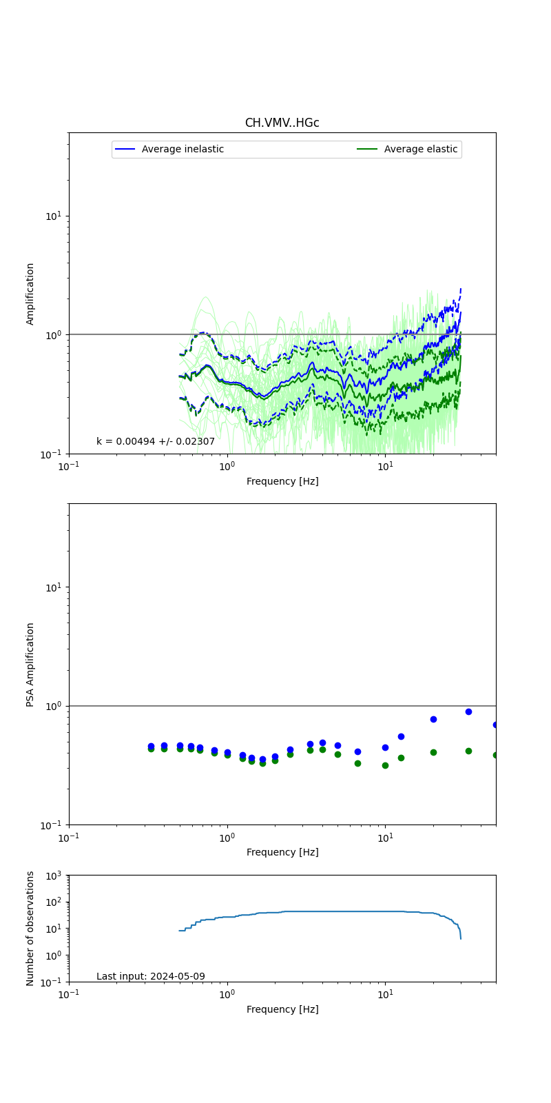 |
| CH.VMV..HH | 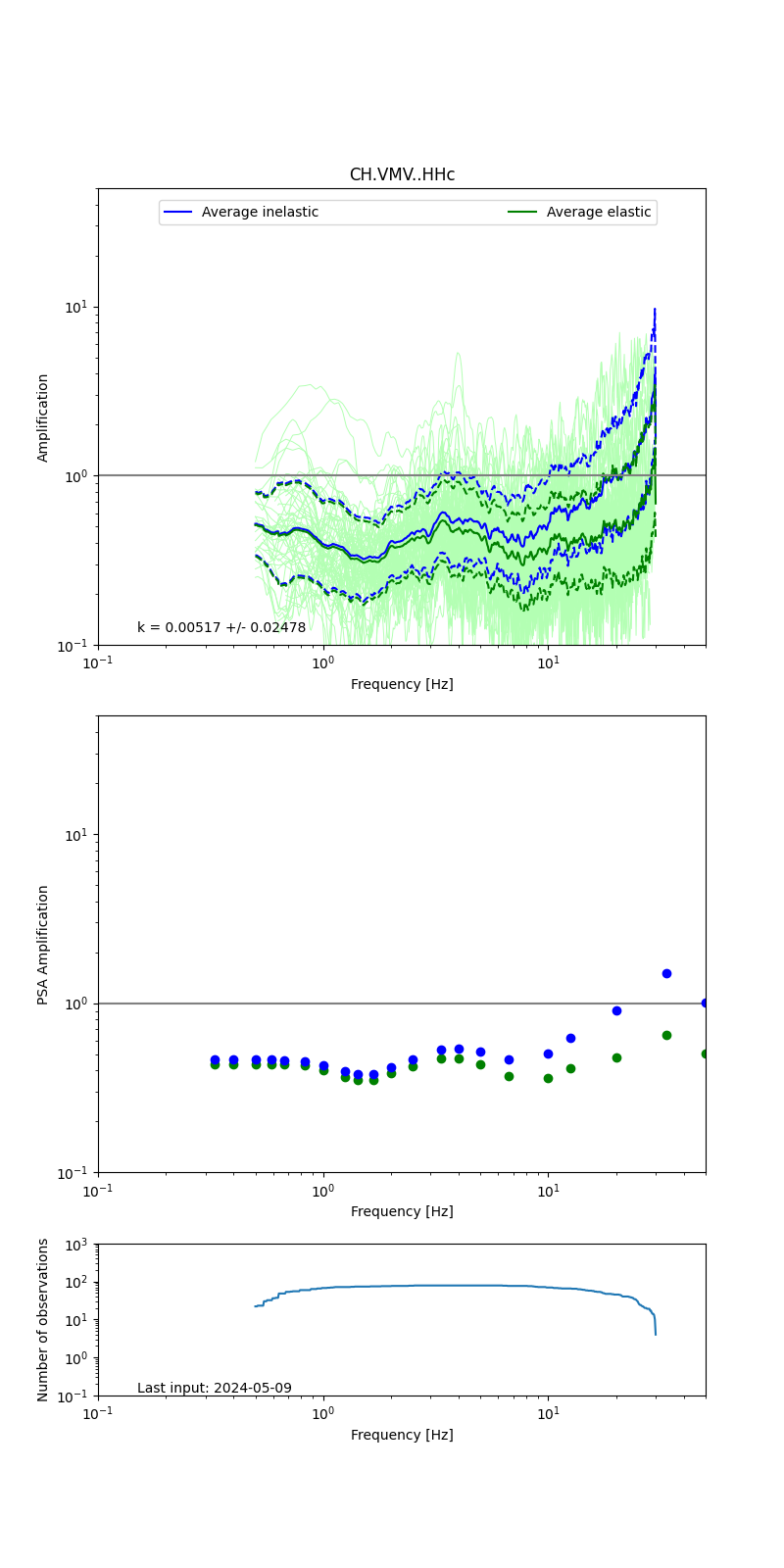 |
Obtained from spectral modeling of small earthquakes with constant update.
- Top: Fourier amplification with elastic (dashed line) and anelastic (solid line) amplification functions;
- Centre: 5% damped response spectra amplification (anelastic);
- Bottom: Number of recordings used.
See Edwards et al. (2013), Determination of Site Amplification from Regional Seismicity: Application to the Swiss National Seismic Networks. Seismological Research Letters, 84(4), 611–621.
| measurements nearby | list... |
|---|