Station Overview
| Overview Location |
 |
|---|---|
| Picture Gallery | details... |
| Geological Unit | Gneiss and Mica-schists |
|---|---|
| Site Morphology Class |
T2 T1: flat; T2: slope; T3: ridge and T4: steep ridge; following Pessina and Fiorini (2014) A GIS procedure for fast topographic characterization of seismic recording stations, Soil Dynamics and Earthquake Engineering, 63, p248-258 |
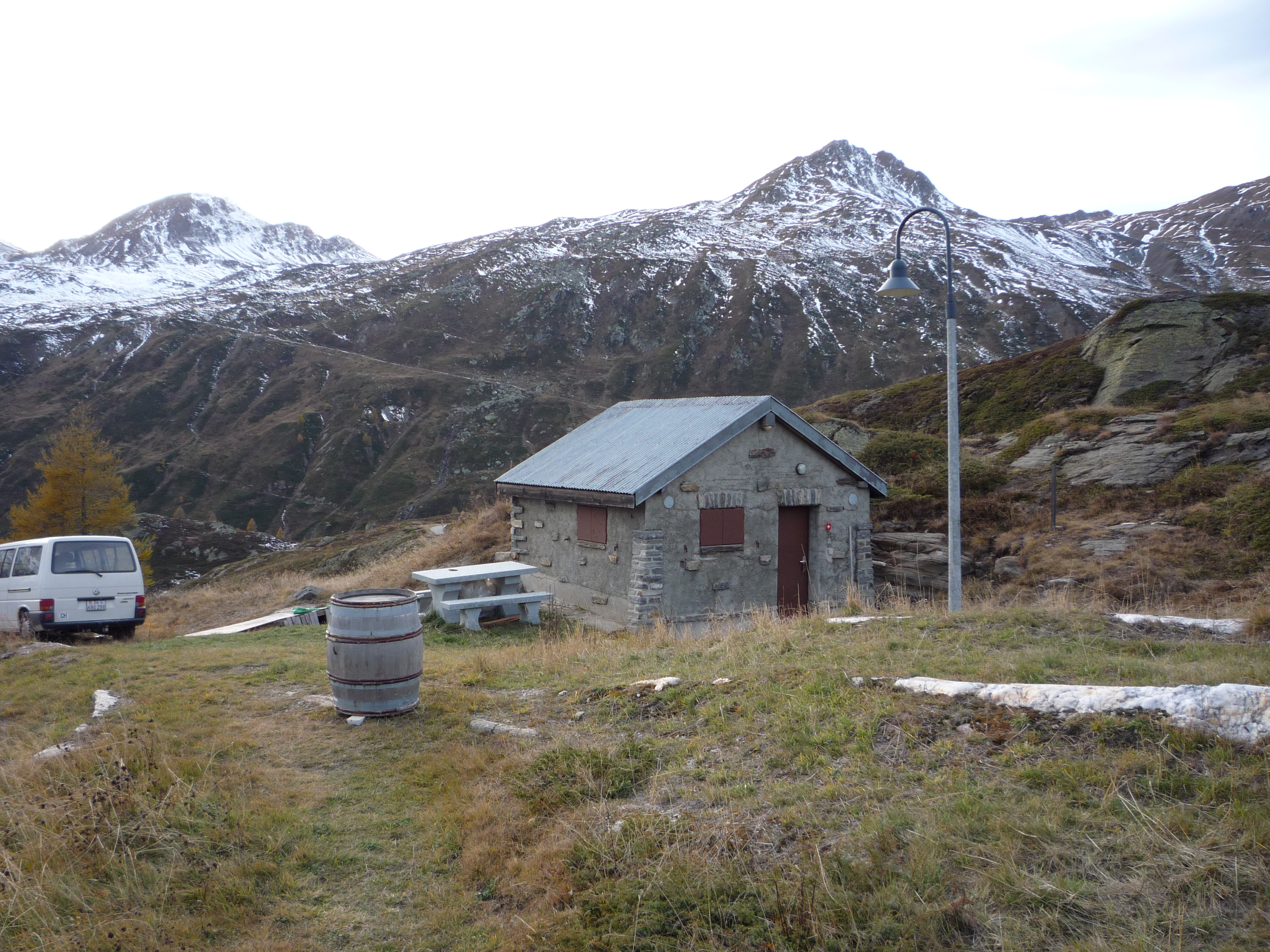
| Site Morphology Description | Mountain pass |
| Ground type EC8 | |
| Ground type SIA | |
| Basin Information | not in a sedimentary basin with possible 2D/3D effects |
| Reference |
Sensor locations
| Location Code | (none) |
|---|---|
| Opening Date | 28-10-2009 |
| End Date | - |
| Housing Class | Tunnel |
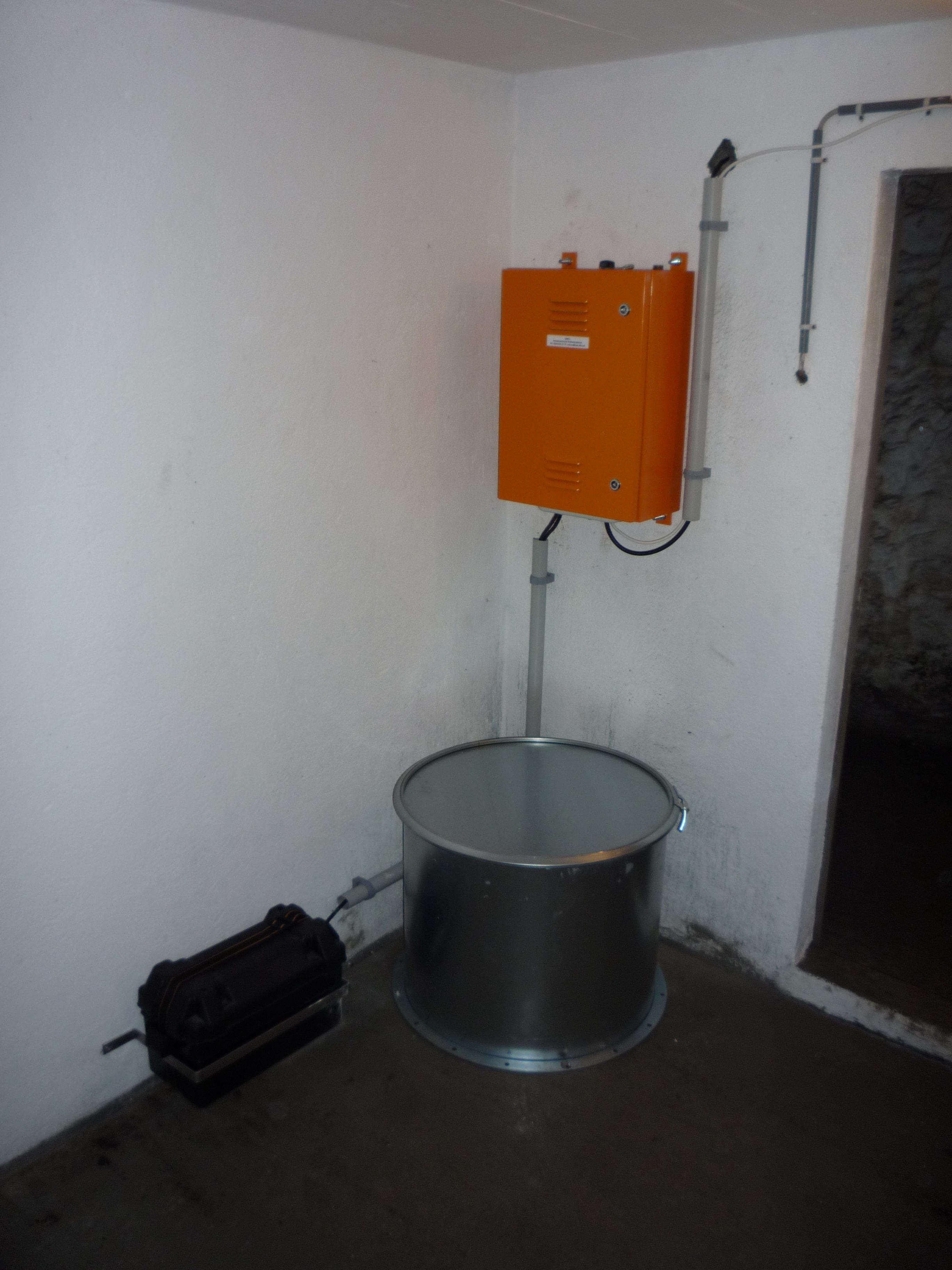
| Housing Description | Sensor in Tunnel 10m directly below free surface, 15m from nearest entrance. Tunnel drilled in rock. It is an abandoned military bunker with several tunnels, stairs and caverns. BB and EPI sensor placed on concrete ground sitting on rock and insulated with a sheet metal cover. EPI sensor installed 0.8m north-west (-45°) of the BB sensor. |
| sensor depth below station | 0.0 m |
| Distance to Building (m) | - |
Current Instrumentation
| Location code | (none) |
|---|---|
| On date | 22-05-2019 14:00:00 |
| Off date | - |
| Sensor model | EpiSensor ES-T |
| Sensor manufacturer | Kinemetrics |
| Digitizer model | Centaur |
| Digitizer manufacturer | Nanometrics |
| Channels | HGE , HGN , HGZ |
| Stream Noise (last week) | HGE , HGN , HGZ |
| Location code | (none) |
|---|---|
| On date | 22-05-2019 14:00:00 |
| Off date | - |
| Sensor model | Trillium 240s_g2 |
| Sensor manufacturer | Nanometrics |
| Digitizer model | Centaur |
| Digitizer manufacturer | Nanometrics |
| Channels | BHE , BHN , BHZ , HHE , HHN , HHZ |
| Stream Noise (last week) | BHE , BHN , BHZ , HHE , HHN , HHZ |
| Location code | (none) |
|---|---|
| On date | 16-07-2014 00:00:00 |
| Off date | 2019-05-22 14:00:00 |
| Waveform Access | open |
| Sensor model | Trillium 40s |
| Sensor manufacturer | Nanometrics |
| Digitizer model | Taurus |
| Digitizer manufacturer | Nanometrics |
| Channels | BHE , BHN , BHZ , HHE , HHN , HHZ |
| Location code | (none) |
|---|---|
| On date | 28-10-2009 00:00:00 |
| Off date | 2014-07-16 00:00:00 |
| Waveform Access | open |
| Sensor model | Trillium 40s |
| Sensor manufacturer | Nanometrics |
| Digitizer model | Taurus |
| Digitizer manufacturer | Nanometrics |
| Channels | BHE , BHN , BHZ , HHE , HHN , HHZ |
Site Characterization
|
channel group |
Empirical Amplification |
|---|---|
| CH.SIMPL..HG | 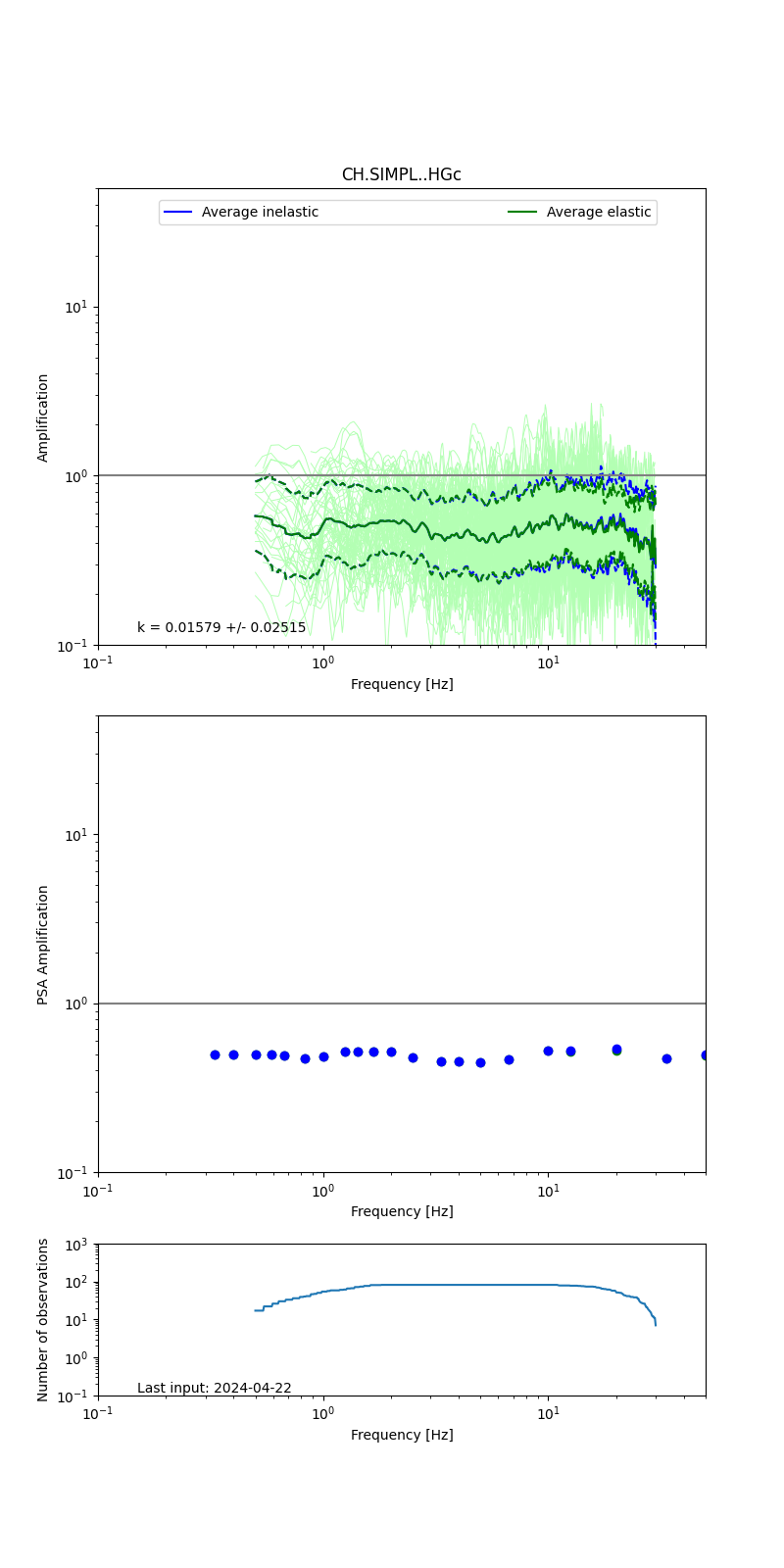 |
| CH.SIMPL..HH |  |
Obtained from spectral modeling of small earthquakes with constant update.
- Top: Fourier amplification with elastic (dashed line) and anelastic (solid line) amplification functions;
- Centre: 5% damped response spectra amplification (anelastic);
- Bottom: Number of recordings used.
See Edwards et al. (2013), Determination of Site Amplification from Regional Seismicity: Application to the Swiss National Seismic Networks. Seismological Research Letters, 84(4), 611–621.
| measurements nearby | list... |
|---|