Station Overview
| Overview Location |
 |
|---|---|
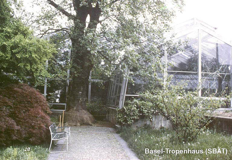
| Picture Gallery | details... |
| Geological Unit | Alluvial terrace (Pleistocene) |
|---|---|
| Site Morphology Class |
T1 T1: flat; T2: slope; T3: ridge and T4: steep ridge; following Pessina and Fiorini (2014) A GIS procedure for fast topographic characterization of seismic recording stations, Soil Dynamics and Earthquake Engineering, 63, p248-258 |
| Site Morphology Description | Terrace above Rhine plain |
| Ground type EC8 | B |
| Ground type SIA | C |
| Basin Information | Rhine basin |
| Reference | Fäh Donat, Fritsche S., Poggi V. et al., "Determination of Site Information for Seismic Stations in Switzerland. Work Package 4: Pegasos Refinement Project", Swiss Seismological Service, ETH Zürich, 2009 |
| Location code | (none) |
|---|---|
| On date | 29-06-2010 00:00:00 |
| Off date | 2019-08-20 08:00:00 |
| Waveform Access | open |
| Sensor model | EpiSensor ES-T |
| Sensor manufacturer | Kinemetrics |
| Digitizer model | Taurus |
| Digitizer manufacturer | Nanometrics |
| Channels | HGE , HGN , HGZ |
| Location code | (none) |
|---|---|
| On date | 12-04-2006 00:00:00 |
| Off date | 2010-06-29 00:00:00 |
| Waveform Access | open |
| Sensor model | EpiSensor ES-T |
| Sensor manufacturer | Kinemetrics |
| Digitizer model | Taurus |
| Digitizer manufacturer | Nanometrics |
| Channels | HGE , HGN , HGZ |
| Location code | (none) |
|---|---|
| On date | 30-03-2006 11:00:00 |
| Off date | 2006-04-12 00:00:00 |
| Waveform Access | open |
| Sensor model | EpiSensor ES-T |
| Sensor manufacturer | Kinemetrics |
| Digitizer model | Taurus |
| Digitizer manufacturer | Nanometrics |
| Channels | HGE , HGN , HGZ |
| Location code | (none) |
|---|---|
| On date | 20-01-2005 13:40:00 |
| Off date | 2006-03-30 11:00:00 |
| Waveform Access | open |
| Sensor model | EpiSensor ES-T |
| Sensor manufacturer | Kinemetrics |
| Digitizer model | |
| Digitizer manufacturer | |
| Channels | HGE , HGN , HGZ |
| Location code | (none) |
|---|---|
| On date | 21-06-2004 00:00:00 |
| Off date | 2005-01-20 13:40:00 |
| Waveform Access | restricted |
| Sensor model | Unity gain generic accelerometer |
| Sensor manufacturer | Generic |
| Digitizer model | UNITY |
| Digitizer manufacturer | generic |
| Channels | EGE , EGN , EGZ |
Site Characterization
|
channel group |
Empirical Amplification |
|---|---|
| CH.SBAT..EG |  |
| CH.SBAT..HG | 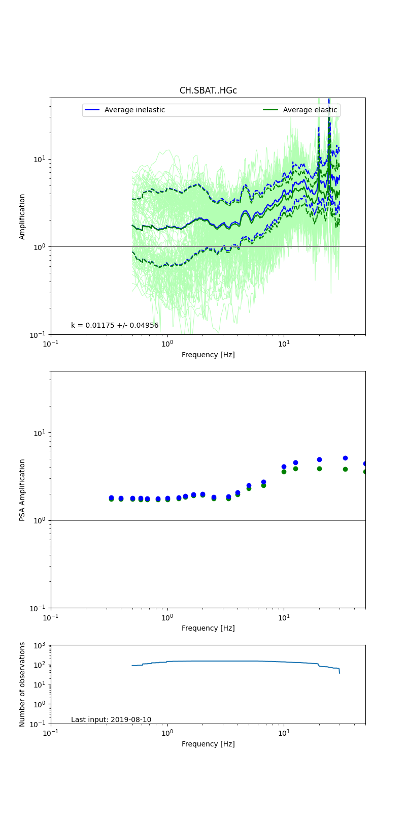 |
Obtained from spectral modeling of small earthquakes with constant update.
- Top: Fourier amplification with elastic (dashed line) and anelastic (solid line) amplification functions;
- Centre: 5% damped response spectra amplification (anelastic);
- Bottom: Number of recordings used.
See Edwards et al. (2013), Determination of Site Amplification from Regional Seismicity: Application to the Swiss National Seismic Networks. Seismological Research Letters, 84(4), 611–621.
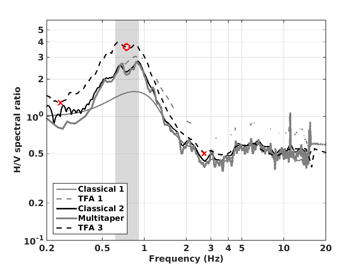
| H/V pick image: |
 |
|---|---|
| Authoritative Site Characterization Analysis | details... |
| measurements nearby | list... |
|---|