Station Overview
| Overview Location | not available |
|---|---|
| Picture Gallery | details... |
| Geological Unit | Alluvial terrace (Pleistocene) |
|---|---|
| Site Morphology Class |
T1 T1: flat; T2: slope; T3: ridge and T4: steep ridge; following Pessina and Fiorini (2014) A GIS procedure for fast topographic characterization of seismic recording stations, Soil Dynamics and Earthquake Engineering, 63, p248-258 |
| Site Morphology Description | Top of a small hill |
| Ground type EC8 | B |
| Ground type SIA | C |
| Basin Information | Rhine basin, interface at fundamental frequency at 45 m depth |
| Reference | Fäh Donat, Steimen S., Oprsal I., Ripperger J., Wössner J., Schatzmann R., Kästli P., Spottke I., Huggenberger P., "The earthquake of 250 A.D. in Augusta Raurica, A real event with a 3D site-effect?", Journal of Seismology, 2006 |
Site Characterization
|
channel group |
Empirical Amplification |
|---|---|
| CH.SAUR..HG | 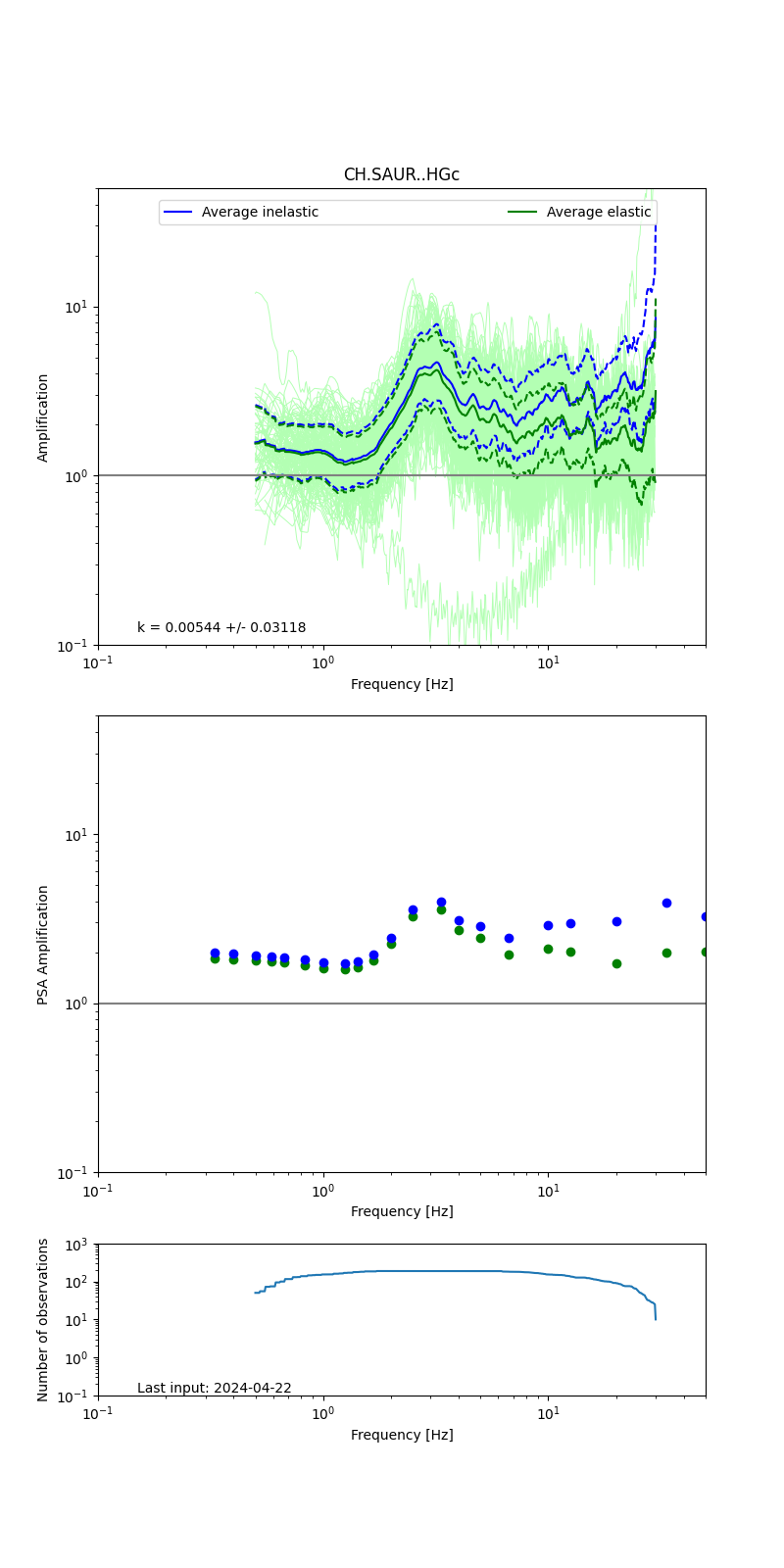 |
Obtained from spectral modeling of small earthquakes with constant update.
- Top: Fourier amplification with elastic (dashed line) and anelastic (solid line) amplification functions;
- Centre: 5% damped response spectra amplification (anelastic);
- Bottom: Number of recordings used.
See Edwards et al. (2013), Determination of Site Amplification from Regional Seismicity: Application to the Swiss National Seismic Networks. Seismological Research Letters, 84(4), 611–621.
| measurements nearby | list... |
|---|