Station Overview
| Overview Location |
 |
|---|---|
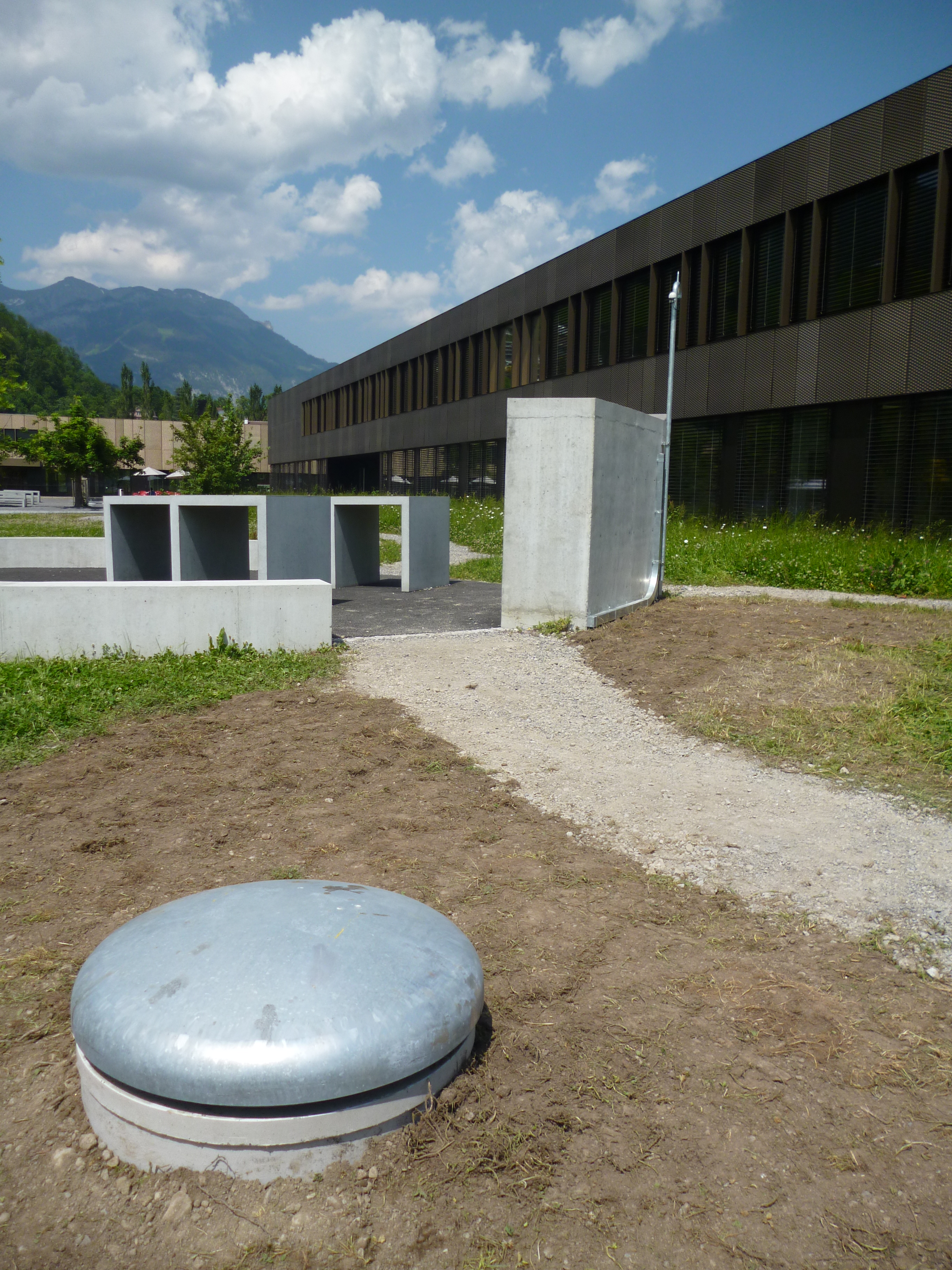
| Picture Gallery | details... |
| Geological Unit | Alluvium |
|---|---|
| Site Morphology Class |
T1 T1: flat; T2: slope; T3: ridge and T4: steep ridge; following Pessina and Fiorini (2014) A GIS procedure for fast topographic characterization of seismic recording stations, Soil Dynamics and Earthquake Engineering, 63, p248-258 |
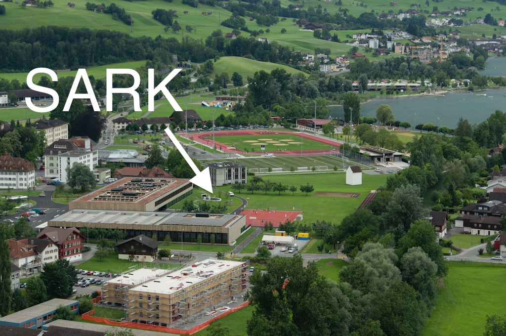
| Site Morphology Description | Plain (in between lake Lucerne and lake Sarnen) |
| Ground type EC8 | B |
| Ground type SIA | E |
| Basin Information | Lake Sarnen basin, interface at fundamental frequency at 160 m depth |
| Reference | Michel Clotaire, Marano S., Poggi V., Burjanek J., Roten D., Cauzzi C., Fäh D., "Sarnen-Kantonsschule (SARK) Site characterization report", Swiss Seismological Service, ETH Zürich, 2013 |
| Location code | (none) |
|---|---|
| On date | 02-10-2014 12:38:00 |
| Off date | 2024-12-11 15:00:00 |
| Waveform Access | open |
| Sensor model | EpiSensor ES-T |
| Sensor manufacturer | Kinemetrics |
| Digitizer model | Taurus |
| Digitizer manufacturer | Nanometrics |
| Channels | HGE , HGN , HGZ |
| Location code | (none) |
|---|---|
| On date | 29-05-2012 00:00:00 |
| Off date | 2014-10-02 12:38:00 |
| Waveform Access | open |
| Sensor model | EpiSensor ES-T |
| Sensor manufacturer | Kinemetrics |
| Digitizer model | Taurus |
| Digitizer manufacturer | Nanometrics |
| Channels | HGE , HGN , HGZ |
Site Characterization
|
channel group |
Empirical Amplification |
|---|---|
| CH.SARK..HG | 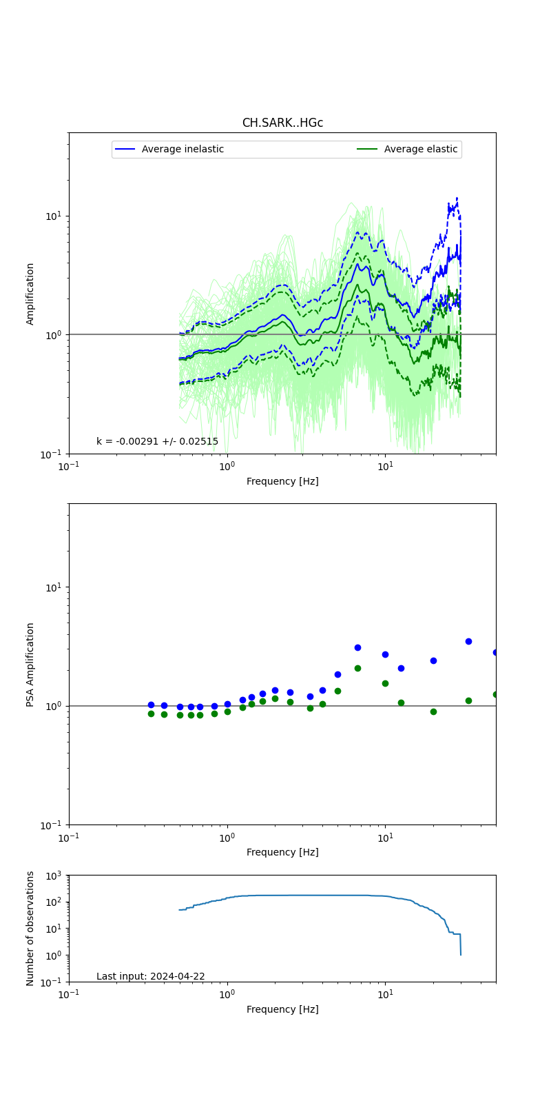 |
Obtained from spectral modeling of small earthquakes with constant update.
- Top: Fourier amplification with elastic (dashed line) and anelastic (solid line) amplification functions;
- Centre: 5% damped response spectra amplification (anelastic);
- Bottom: Number of recordings used.
See Edwards et al. (2013), Determination of Site Amplification from Regional Seismicity: Application to the Swiss National Seismic Networks. Seismological Research Letters, 84(4), 611–621.
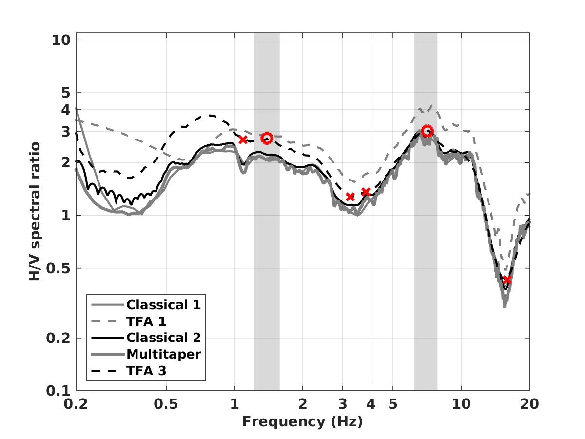
| H/V pick image: |
 |
|---|---|
| Authoritative Site Characterization Analysis | details... |
| measurements nearby | list... |
|---|