Sensor locations
| Location Code | (none) |
|---|---|
| Opening Date | 06-03-2020 |
| End Date | - |
| Housing Class | old military bunker |
| Housing Description | 2 story building, sensors in the basement directly on the foundation, building is dry and all over the year more or less same temperature |
| sensor depth below station | 0.0 m |
| Distance to Building (m) | 300 |
Current Instrumentation
| Location code | (none) |
|---|---|
| On date | 06-03-2020 17:00:00 |
| Off date | - |
| Sensor model | EpiSensor ES-T |
| Sensor manufacturer | Kinemetrics |
| Digitizer model | Centaur |
| Digitizer manufacturer | Nanometrics |
| Channels | HGE , HGN , HGZ |
| Stream Noise (last week) | HGE , HGN , HGZ |
| Location code | (none) |
|---|---|
| On date | 06-03-2020 17:00:00 |
| Off date | - |
| Sensor model | Trillium Compact 120s |
| Sensor manufacturer | Nanometrics |
| Digitizer model | Centaur |
| Digitizer manufacturer | Nanometrics |
| Channels | BHE , BHN , BHZ , HHE , HHN , HHZ |
| Stream Noise (last week) | BHE , BHN , BHZ , HHE , HHN , HHZ |
Site Characterization
|
channel group |
Empirical Amplification |
|---|---|
| CH.MUTEZ..HG | 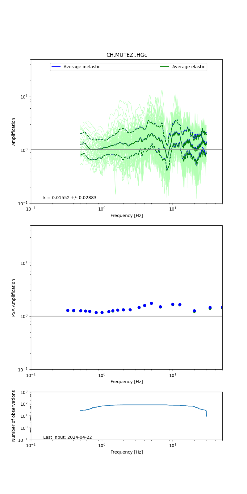 |
| CH.MUTEZ..HH | 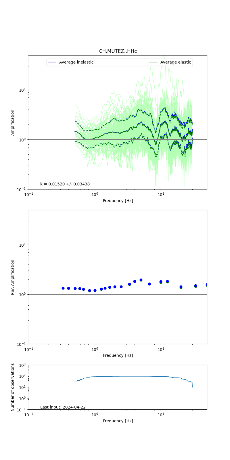 |
Obtained from spectral modeling of small earthquakes with constant update.
- Top: Fourier amplification with elastic (dashed line) and anelastic (solid line) amplification functions;
- Centre: 5% damped response spectra amplification (anelastic);
- Bottom: Number of recordings used.
See Edwards et al. (2013), Determination of Site Amplification from Regional Seismicity: Application to the Swiss National Seismic Networks. Seismological Research Letters, 84(4), 611–621.
| measurements nearby | list... |
|---|