Station Overview
| Overview Location |
 |
|---|---|
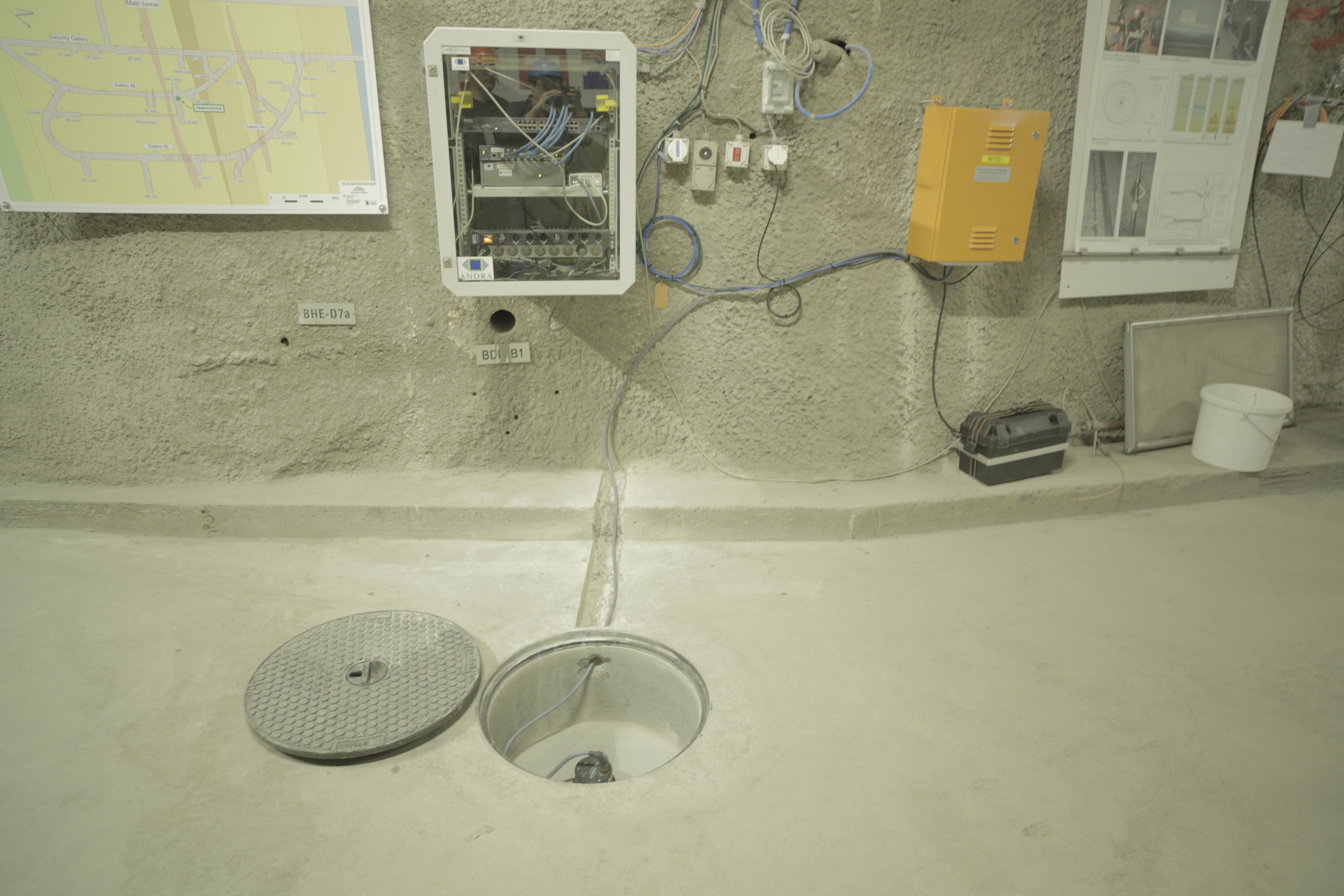
| Picture Gallery | details... |
| Geological Unit | Opalinus clay of Aalenian age |
|---|---|
| Site Morphology Class | |
| Site Morphology Description | Underground below a hill |
| Ground type EC8 | A |
| Ground type SIA | A |
| Basin Information | not in a sedimentary basin with possible 2D/3D effects |
| Reference | Michel Clotaire, Poggi V., Fäh D., "Report on site characterization, Mont Terri, Switzerland", Swiss Seismological Service, ETH Zürich, 2014 |
Sensor locations
| Location Code | (none) |
|---|---|
| Opening Date | 19-05-2014 |
| End Date | - |
| Housing Class | Tunnel |
| Housing Description | Sensor in tunnel 290 m directly below free surface, 500m from tunnel entrance. Sensor placed on isolated (1m x 1m x 0.5m high) concrete foundation in a 5m deep shaft on rock. In large tunnel complex (Mont Terri Rock lab). |
| sensor depth below station | 0.0 m |
| Distance to Building (m) | - |
Current Instrumentation
| Location code | (none) |
|---|---|
| On date | 19-05-2014 00:00:00 |
| Off date | - |
| Sensor model | STS2.5 |
| Sensor manufacturer | Streckeisen |
| Digitizer model | Trident |
| Digitizer manufacturer | Nanometrics |
| Channels | BHE , BHN , BHZ |
| Stream Noise (last week) | BHE , BHN , BHZ |
| Location code | (none) |
|---|---|
| On date | 14-11-2024 10:02:00 |
| Off date | - |
| Sensor model | STS2.5 |
| Sensor manufacturer | Streckeisen |
| Digitizer model | Trident |
| Digitizer manufacturer | Nanometrics |
| Channels | HHE , HHN , HHZ |
| Stream Noise (last week) | HHE , HHN , HHZ |
Site Characterization
|
channel group |
Empirical Amplification |
|---|---|
| CH.MTI02..HH | 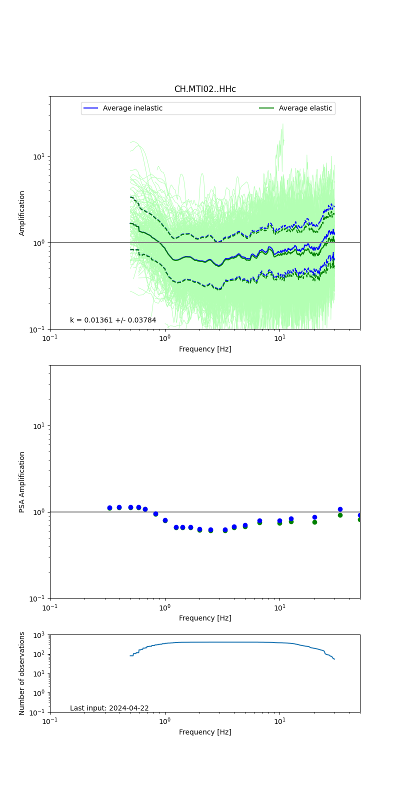 |
Obtained from spectral modeling of small earthquakes with constant update.
- Top: Fourier amplification with elastic (dashed line) and anelastic (solid line) amplification functions;
- Centre: 5% damped response spectra amplification (anelastic);
- Bottom: Number of recordings used.
See Edwards et al. (2013), Determination of Site Amplification from Regional Seismicity: Application to the Swiss National Seismic Networks. Seismological Research Letters, 84(4), 611–621.
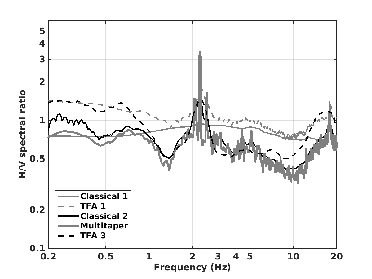
| H/V pick image: |
 |
|---|---|
| Authoritative Site Characterization Analysis | details... |
| measurements nearby | list... |
|---|