Sensor locations
| Location Code | BT |
|---|---|
| Opening Date | 04-12-2017 |
| End Date | 2023-08-16 |
| Housing Class | Borehole |
| Housing Description | casing: metal; casing length: 170m; diameter: 15cm; locking mechanism: none; wet. Sensor is in 5m mud. Mud from 165-170m depth |
| sensor depth below station | 170.0 m |
| Distance to Building (m) | - |
| Location Code | SF |
|---|---|
| Opening Date | 04-12-2017 |
| End Date | 2023-08-16 |
| Housing Class | Building |
| Housing Description | Sensor in ground floor in corner of 1 story building with building footprint 20m x 20m. Building type: concrete/brick/wood. Building density: isolated building. Building usage: for storage / abandoned / inhabited. Sensor coupling information right on the concrete grounde. |
| sensor depth below station | 0.0 m |
| Distance to Building (m) | - |
| Location code | BT |
|---|---|
| On date | 10-01-2019 00:00:00 |
| Off date | 2023-08-16 12:00:00 |
| Waveform Access | open |
| Sensor model | G88-4.5Hz |
| Sensor manufacturer | IESE |
| Digitizer model | Centaur |
| Digitizer manufacturer | Nanometrics |
| Channels | EH2 , EH3 , EHZ |
| Location code | SF |
|---|---|
| On date | 04-12-2017 18:00:00 |
| Off date | 2022-11-02 08:00:00 |
| Waveform Access | open |
| Sensor model | EpiSensor ES-T |
| Sensor manufacturer | Kinemetrics |
| Digitizer model | Centaur |
| Digitizer manufacturer | Nanometrics |
| Channels | HGE , HGN , HGZ |
Site Characterization
|
channel group |
Empirical Amplification |
|---|---|
| CH.LAVEY.BT.EH | 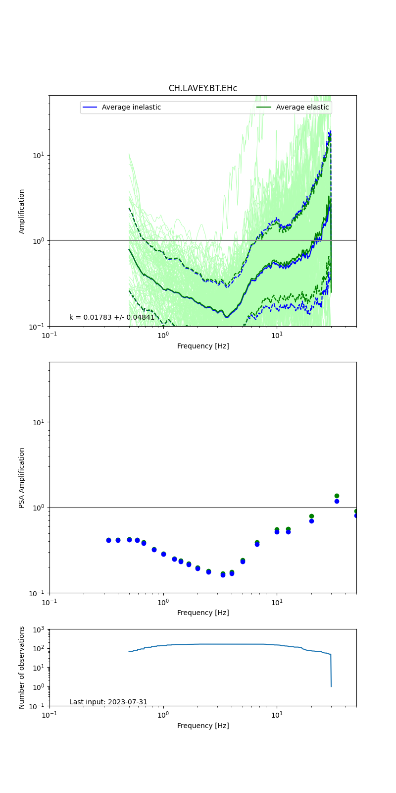 |
| CH.LAVEY.SF.HG | 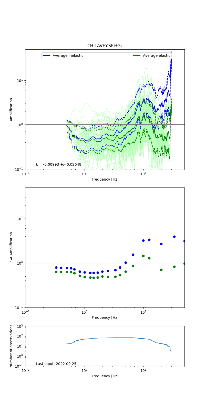 |
Obtained from spectral modeling of small earthquakes with constant update.
- Top: Fourier amplification with elastic (dashed line) and anelastic (solid line) amplification functions;
- Centre: 5% damped response spectra amplification (anelastic);
- Bottom: Number of recordings used.
See Edwards et al. (2013), Determination of Site Amplification from Regional Seismicity: Application to the Swiss National Seismic Networks. Seismological Research Letters, 84(4), 611–621.
| measurements nearby | list... |
|---|