Sensor locations
| Location Code | (none) |
|---|---|
| Opening Date | 23-08-2018 |
| End Date | - |
| Housing Class | Tunnel |
| Housing Description | Sensor in tunnel, 18m directly below free surface, 13 from nearest entrance. Small abandoned military bunker on the western slope of Mount Euschelsfluh, consisting of three rooms (~12m2 each) at the northern end and a 22m long / 1.5m wide tunnel heading to the entrance at the south side. Both sensors are installed in a niche (3.5m2) in the tunnel, directly on the concrete floor and insulated with a sheet metal cover. |
| sensor depth below station | 0.0 m |
| Distance to Building (m) | - |
Current Instrumentation
| Location code | (none) |
|---|---|
| On date | 23-08-2018 06:00:00 |
| Off date | - |
| Sensor model | EpiSensor ES-T |
| Sensor manufacturer | Kinemetrics |
| Digitizer model | Centaur |
| Digitizer manufacturer | Nanometrics |
| Channels | HGE , HGN , HGZ |
| Stream Noise (last week) | HGE , HGN , HGZ |
| Location code | (none) |
|---|---|
| On date | 23-08-2018 06:00:00 |
| Off date | - |
| Sensor model | Trillium 240s_g2 |
| Sensor manufacturer | Nanometrics |
| Digitizer model | Centaur |
| Digitizer manufacturer | Nanometrics |
| Channels | BHE , BHN , BHZ , HHE , HHN , HHZ |
| Stream Noise (last week) | BHE , BHN , BHZ , HHE , HHN , HHZ |
Site Characterization
|
channel group |
Empirical Amplification |
|---|---|
| CH.JAUN..HG | 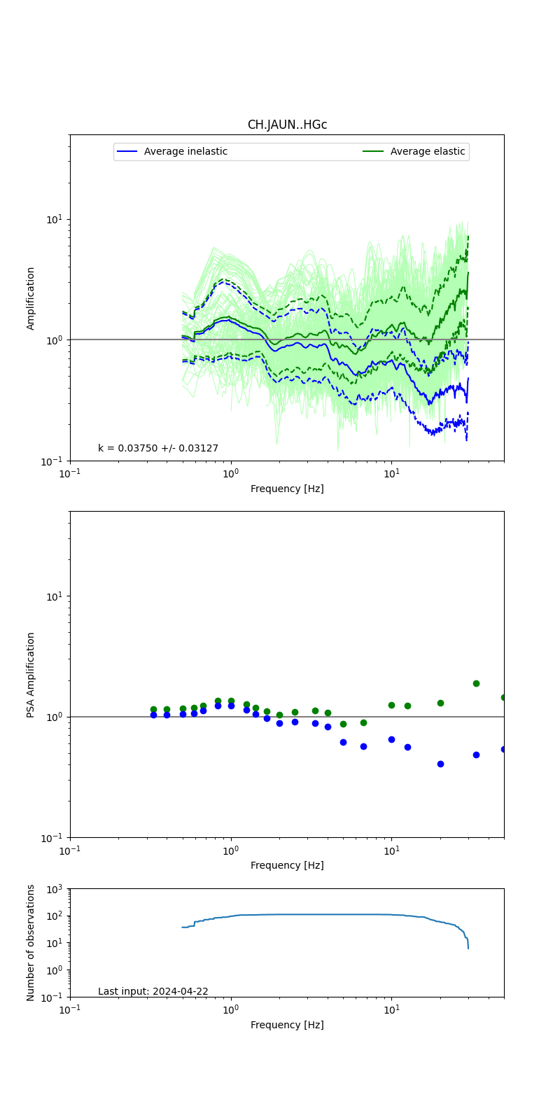 |
| CH.JAUN..HH | 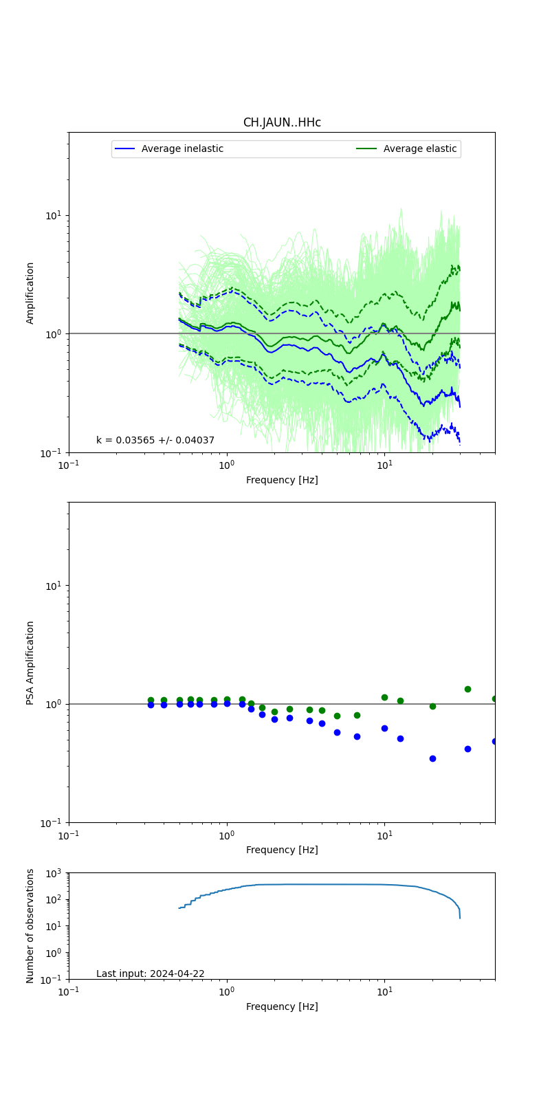 |
Obtained from spectral modeling of small earthquakes with constant update.
- Top: Fourier amplification with elastic (dashed line) and anelastic (solid line) amplification functions;
- Centre: 5% damped response spectra amplification (anelastic);
- Bottom: Number of recordings used.
See Edwards et al. (2013), Determination of Site Amplification from Regional Seismicity: Application to the Swiss National Seismic Networks. Seismological Research Letters, 84(4), 611–621.
| measurements nearby | list... |
|---|