Sensor locations
| Location Code | (none) |
|---|---|
| Opening Date | 21-11-2017 |
| End Date | - |
| Housing Class | Urban free field |
| Housing Description | Sensor installed within tank of a former water reservoir. Sensor on basement close to the center of the cylindrical former water tank Diameter of tank about 15 m. Building type: concrete. Building density: isolated building. Sensor placed directly on concrete floor, covered with plastic pot. The new water reservoir is located about 50-60 m from the old reservoir and it cannot be excluded that pipes run below/next to the old reservoir. A weekend house is located in a distance of about 50 m from the old reservoir. Dirt road in front of the former reservoir seems to be hiking trail in summer and winter. Distance to building: 50 m |
| sensor depth below station | 0.0 m |
| Distance to Building (m) | - |
Site Characterization
|
channel group |
Empirical Amplification |
|---|---|
| 8D.RAW4..EH | 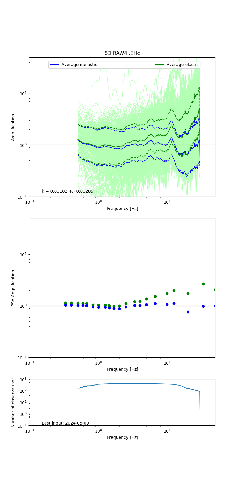 |
Obtained from spectral modeling of small earthquakes with constant update.
- Top: Fourier amplification with elastic (dashed line) and anelastic (solid line) amplification functions;
- Centre: 5% damped response spectra amplification (anelastic);
- Bottom: Number of recordings used.
See Edwards et al. (2013), Determination of Site Amplification from Regional Seismicity: Application to the Swiss National Seismic Networks. Seismological Research Letters, 84(4), 611–621.
| measurements nearby | list... |
|---|