Sensor locations
| Location Code | (none) |
|---|---|
| Opening Date | 12-10-2016 |
| End Date | - |
| Housing Class | Urban free field |
| Housing Description | Service room in a cabin of the road maintenance staff of the Canton Valais. The cabin hosts batteries, which are used as power supply for lightning of a nearby tunnel. The batteries are charged by solar panels mounted on 4 metal poles (height about 4-6 m from ground) in a distance of about 10 m to the cabin. Sensor in SE corner the 1 story building with building footprint 6m x 3m. Building type: concrete. Building density: isolated building. Sensor placed directly on concrete floor, covered with plastic pot, insulated with rubber foam. |
| sensor depth below station | 0.0 m |
| Distance to Building (m) | 310 |
Site Characterization
|
channel group |
Empirical Amplification |
|---|---|
| 8D.RAW2..HH | 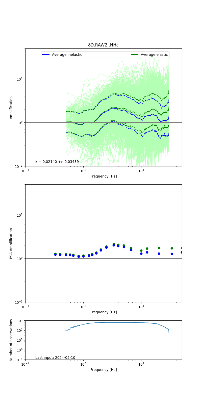 |
Obtained from spectral modeling of small earthquakes with constant update.
- Top: Fourier amplification with elastic (dashed line) and anelastic (solid line) amplification functions;
- Centre: 5% damped response spectra amplification (anelastic);
- Bottom: Number of recordings used.
See Edwards et al. (2013), Determination of Site Amplification from Regional Seismicity: Application to the Swiss National Seismic Networks. Seismological Research Letters, 84(4), 611–621.
| measurements nearby | list... |
|---|