Station Overview

Overview Location not available
Picture Gallery details...
Network 8D
Station Code QEG00
Station Description Eglisau, Reservoir Grafenholz, ZH
Latitude (WGS84) 47.58145
Longitude (WGS84) 8.5373
Station altitude (CH1903) 494.0
running from 2016-10-14
...until now
Waveform Access open
Sensor Types Velocimeter
Geological Unit
Site Morphology Class
Site Morphology Description
Ground type EC8
Ground type SIA
Basin Information no information available
Reference
Resonance Frequency (Hz) -
Uncertainty Factor -
Vs 30 (m/s) -
Location Map


Federal Office of Topograpy: National Map 1:25‘000
Topography Map


Federal Office of Topograpy: DHM25: Digital Height Model 1:25000
Geology Map

Federal Office of Topograpy: Geological map of Switzerland 1:500‘000

Sensor locations

Location Code (none)
Opening Date 14-10-2016
End Date -
Housing Class Underground shelter
Housing Description Water reservoir. Sensor in underground shelter 6m directly below free surface, 14m from nearest entrance. Sensor on concrete foundation, between two large water tanks. Tanks connected by 200mm tube 30cm from sensor.
sensor depth below station 6.0 m
Distance to Building (m) 200

Current Instrumentation

Location code (none)
On date 06-03-2019 07:25:00
Off date -
Sensor model LE-3DliteMkIII
Sensor manufacturer Lennartz
Digitizer model Centaur
Digitizer manufacturer Nanometrics
Channels EHE , EHN , EHZ
Stream Noise (last week) EHE , EHN , EHZ
Location code (none)
On date 14-10-2016 15:00:00
Off date 2019-03-06 07:25:00
Waveform Access open
Sensor model LE-3D-1s
Sensor manufacturer Lennartz
Digitizer model Taurus
Digitizer manufacturer Nanometrics
Channels EHE , EHN , EHZ

Site Characterization

channel group
Empirical Amplification
8D.QEG00..EH not available

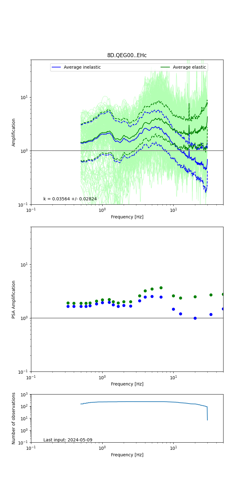
Obtained from spectral modeling of small earthquakes with constant update.

  • Top: Fourier amplification with elastic (dashed line) and anelastic (solid line) amplification functions;
  • Centre: 5% damped response spectra amplification (anelastic);
  • Bottom: Number of recordings used.

See Edwards et al. (2013), Determination of Site Amplification from Regional Seismicity: Application to the Swiss National Seismic Networks. Seismological Research Letters, 84(4), 611–621.

H/V pick image: not available
Authoritative Site Characterization Analysis -
measurements nearby list...