Sensor locations
| Location Code | (none) |
|---|---|
| Opening Date | 25-10-2019 |
| End Date | 2022-04-04 |
| Housing Class | Free field |
| Housing Description | sensor buried in soil, standing on a concrete slab which is lying directly on the soil, covered with a plastic cap (mobile station Zarges box with solar panel) |
| sensor depth below station | 0.0 m |
| Distance to Building (m) | 250 |
| Location code | (none) |
|---|---|
| On date | 01-09-2021 13:30:00 |
| Off date | 2022-04-04 13:26:00 |
| Waveform Access | open |
| Sensor model | Trillium Compact 120s |
| Sensor manufacturer | Nanometrics |
| Digitizer model | Centaur |
| Digitizer manufacturer | Nanometrics |
| Channels | BHE , BHN , BHZ , HHE , HHN , HHZ |
| Location code | (none) |
|---|---|
| On date | 25-10-2019 18:00:00 |
| Off date | 2021-06-01 16:08:00 |
| Waveform Access | open |
| Sensor model | Trillium Compact 120s |
| Sensor manufacturer | Nanometrics |
| Digitizer model | Centaur |
| Digitizer manufacturer | Nanometrics |
| Channels | BHE , BHN , BHZ , HHE , HHN , HHZ |
Site Characterization
|
channel group |
Empirical Amplification |
|---|---|
| 8D.LULY1..HH | 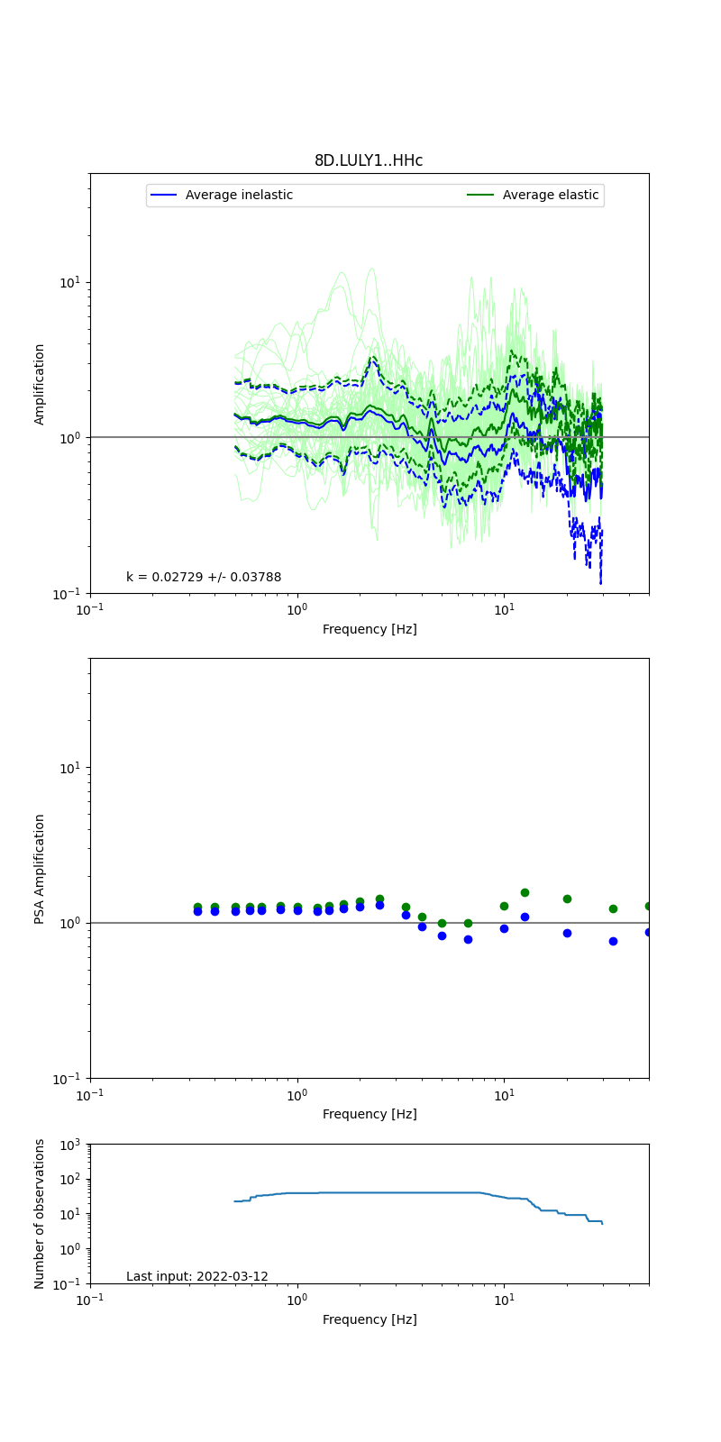 |
Obtained from spectral modeling of small earthquakes with constant update.
- Top: Fourier amplification with elastic (dashed line) and anelastic (solid line) amplification functions;
- Centre: 5% damped response spectra amplification (anelastic);
- Bottom: Number of recordings used.
See Edwards et al. (2013), Determination of Site Amplification from Regional Seismicity: Application to the Swiss National Seismic Networks. Seismological Research Letters, 84(4), 611–621.
| measurements nearby | list... |
|---|